


 3:38 AM
 Ronson

DIGITAL ELEVATION MODEL AND IT’S CARTOGRAPHIC APPLICATION
Digital Elevation Model is the data used by Geographical Information System to represent the shape or part of the earth’s surface. It usually refers to data in raster format where each raster cells stores the height of the ground above sea level or some known datum. Digital Elevation Model (DEM) is a numerical representation of the Earth’s surface that contains actual height points representing the topography, as well as the method to calculate elevations between the height points. Typically, DEM is stored in a data system as a regular grid or a triangulated irregular network (TIN).
Digital Elevation Models (DEMs) are a type of raster GIS layer. Raster GIS represents the world as a regular arrangement of locations. In a DEM, each cell has a value corresponding to its elevation. The fact that locations are arranged regularly permits the raster GIS to infer many interesting associations among locations: Which cells are upstream from other cells? Which locations are visible from a given point? Where are the steep slopes? One of the most powerful applications of DEMs is adding synthetic hillshading to maps so that the map reader may see the relationship between terrain and other things you may be mapping.
DTM model is mostly related as raster data type (opposed to vector data type), stored usually as a rectangular equal-spaced grid, with space (resolution) of between 50 and 500 meters mostly presented in cartesian coordinate system – i.e. x, y, z (there are DTMs presented in geographic coordinate system – i.e. angular coordinates of latitude and longitude). For several applications a higher resolution is required (as high as 1 meter spacing). A DTM can be used to guide automatic machinery in the construction of a physical model or even in computer games, where is describes the relief map.
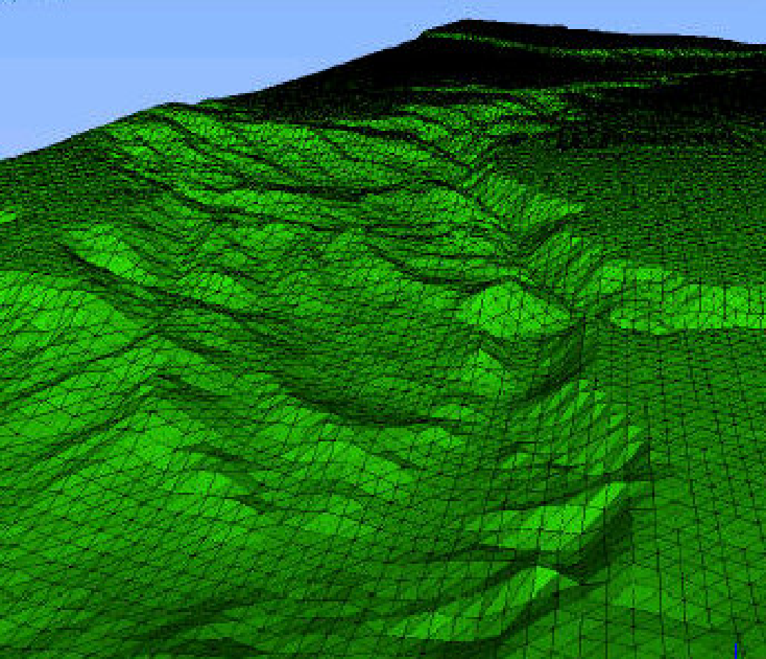
Fig. Grid DTM terrain relief representation
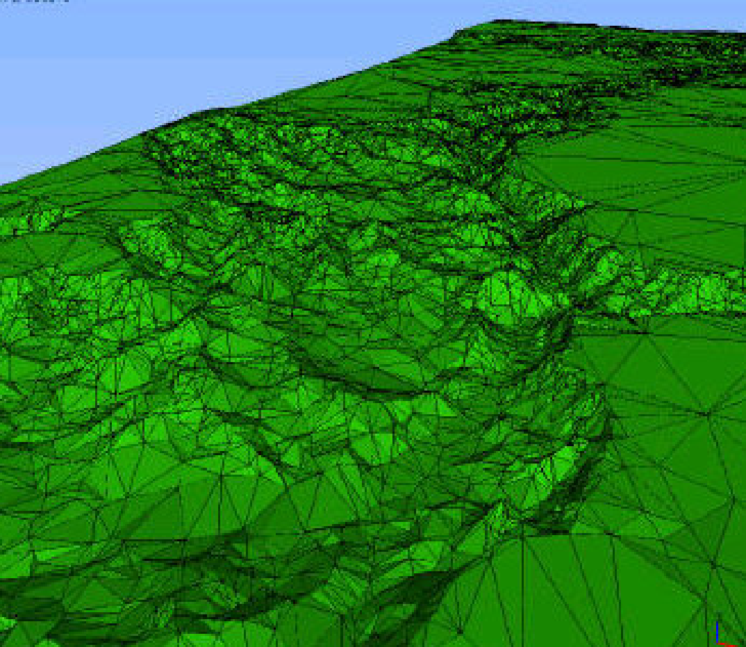
Fig. TIN terrain relief representation
Methods for obtaining elevation data used to create DEMs:
1. Stereo photogrammetry from aerial surveys, 2.Block adjustment from optical satellite imagery, 3.Interferometry from radar data, 4.Real Time Kinematic GPS, 5.Topographic maps, 6.Theodolite or total station, 7.Doppler radar, 8.Focus variation, 9.Inertial surveys, 10.Surveying and mapping drones.
IT’S APPLICATION
The DTM data sets are extremely useful for the generation of 3D renderings of any location in the area described. 3D models rendered from DTM data can be extremely useful and versatile for a variety of applications.
DTMs are used especially in civil engineering, geodesy & surveying, geophysics, and geography
Common uses of DEMs include:
1. Extracting terrain parameters
2. Modeling water flow or mass movement (for example avalanches and landslides)
3. Creation of relief maps
4. Rendering of 3D visualizations.
5. 3D flight planning
6. Creation of physical models (including raised relief maps)
7. Rectification of aerial photography or satellite imagery
8. Reduction (terrain correction) of gravity measurements (gravimetry, physical geodesy)
9. Terrain analysis in geomorphology and physical geography
10. Geographic Information Systems (GIS)
11. Engineering and infrastructure design
12. Global positioning systems (GPS)
13. Line-of-sight analysis
14. Base mapping
15. Flight simulation
16. Precision farming and forestry
17. Surface analysis


4 comments:
We are urgently in need of kidney donors in Kokilaben Hospital India for the sum of $450,000,00,WhatsApp +917418483326
Tel: +91 9036106919
Email: kokilabendhirubhaihospital@gmail.com
We are urgently in need of kidney donor in a very good health condition for the sum of $470,000,00 and we will take properly care of the donor doling the whole process, here you can contact us via email address: ahospital661@gmail.com or phone number-+919677345881 by name Dr Donald Moore.
We are urgently in need of kidney donors in Kokilaben Hospital India for the sum of $500,000,00,( 3 CRORE INDIA RUPEES) All donors are to reply via Email only: hospitalcarecenter@gmail.com or Email: kokilabendhirubhaihospital@gmail.com
WhatsApp +91 7795833215
We are urgently in need of kidney donors with the sum of $500,000.00 USD (3 crore) and Also In Foreign currency. Apply Now!,For more info Email: healthc976@gmail.com
Post a Comment